Originally used for mules pulling canal boats, the Ohio & Erie Canal Towpath Trail is now the key walking, running, and biking route through the Ohio & Erie Canalway National Heritage Area.
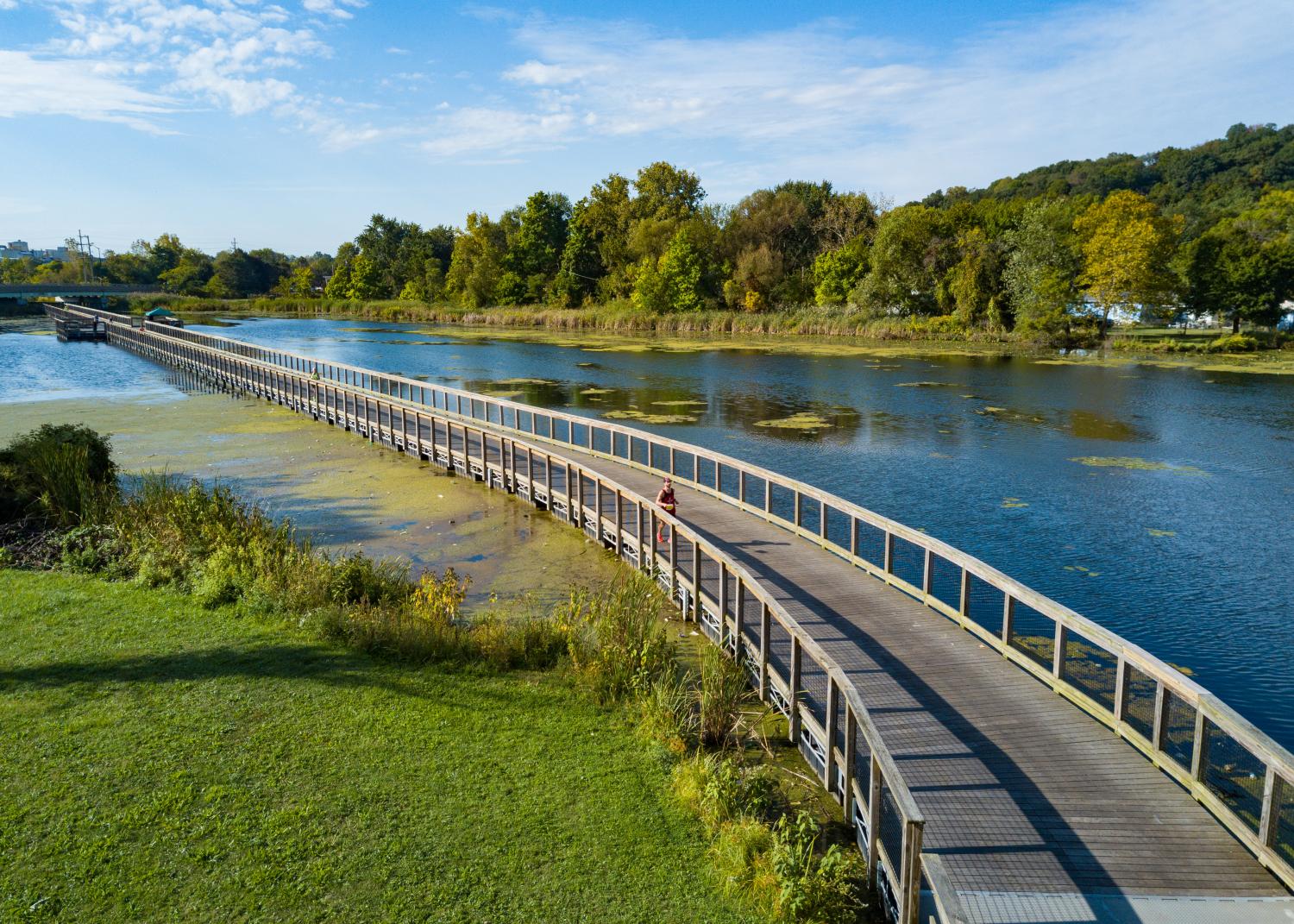
The Towpath Trail follows closely, though not entirely, along the original route of the Ohio & Erie Canal and provides natural, cultural, historical, and recreational opportunities throughout.
The Ohio & Erie Canal Towpath Trail the northern-most section of Ohio Bike Route 1, or the Ohio to Erie Trail, a 326-mile route traversing various trails that allows cyclists to ride from the Ohio River to Lake Erie.
The Ohio & Erie Canalway Coalition supports the development of the Towpath Trail in Summit, Stark, and Tuscarawas Counties, with sister organization Canalway leading efforts in Cuyahoga County. The Towpath Trail is anticipated to be completed by 2030, with the remaining miles in planning and development. Help support our efforts to complete the Towpath Trail by 2030!
Contribute to the TWPTH 2030 Campaign
Learn more about the development of future Ohio & Erie Canal Towpath Trail sections below. To learn more about visiting the Towpath Trail, visit the Ohio & Erie Canalway National Heritage Area website.
Completing 101 miles of the Ohio & Erie Canal Towpath Trail
Currently spanning over 90 continuous miles long across four counties, the Towpath Trail is estimated to be 101 miles when complete.
Currently in various stages of planning, design, fundraising and implementation. In June 2025, we were notified by the Ohio Department of Transportation and Governor DeWine's Office that the City of Dover, City of New Philadelphia, and Tuscarawas County were awarded $4.9 million towards developing 7 miles of the Ohio & Erie Canal Towpath Trail beginning in 2028.
State Routes 800 to 416
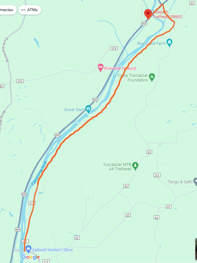 South of Zoarville, the Towpath Trail continues across State Route 800. Here, the trail will follow the Zoar Valley Trail, across the Zoarville Bridge, before heading south parallel to the Tuscarawas River.
Tuscarawas County Commissioners and the Ohio & Erie Canalway Coalition entered into a license agreement with land owner Kimble Company for the development of the Towpath Trail along this section. In 2019, the Ohio Department of Transportation announced a $483,000 Transportation Alternatives Program grant to be awarded to Tuscarawas County Commissioners.
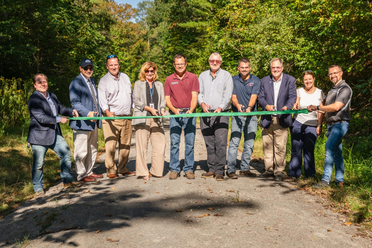
Phase I from SR-800 (Zoarville) to the Dover Dam is now complete and dedicated on September 9, 2025. Phase II from the Dover Dam to State Route 416 includes improvements to an already present access road to the Dover Dam to add a full 4 miles to the Ohio & Erie Canal Towpath Trail. The full 4 miles are now accessible to pedestrians and bicyclists, but Phase II improvements will begin in 2028.
State Route 416 to Downtown Dover
After crossing State Route 416, the Towpath Trail is planned to continue along the Tuscarawas River into the heart of Dover. Studies and partnership conversations are currently underway to determine the feasibility of routes throughout this section.
Dover to Waterworks Park
We are facilitating a design and planning study to identify the route of the Ohio & Erie Canal Towpath Trail from Dover to Waterworks Park in New Philadelphia. We are also collaborating with the City of New Philadelphia, Tuscarawas County Commissioners, and area businesses on the implementation of the New Philadelphia Bicycle and Pedestrian Connectivity Plan.